
Εκτίμηση της τρωτότητας του υπόγειου υδροφορέα της λεκάνης Καστοριάς στην εξωτερική ρύπανση με τη μέθοδο DRASTIC = Aquifer vulnerability assessment to external pollution using the DRASTIC method in Kastoria basin.
Περίληψη
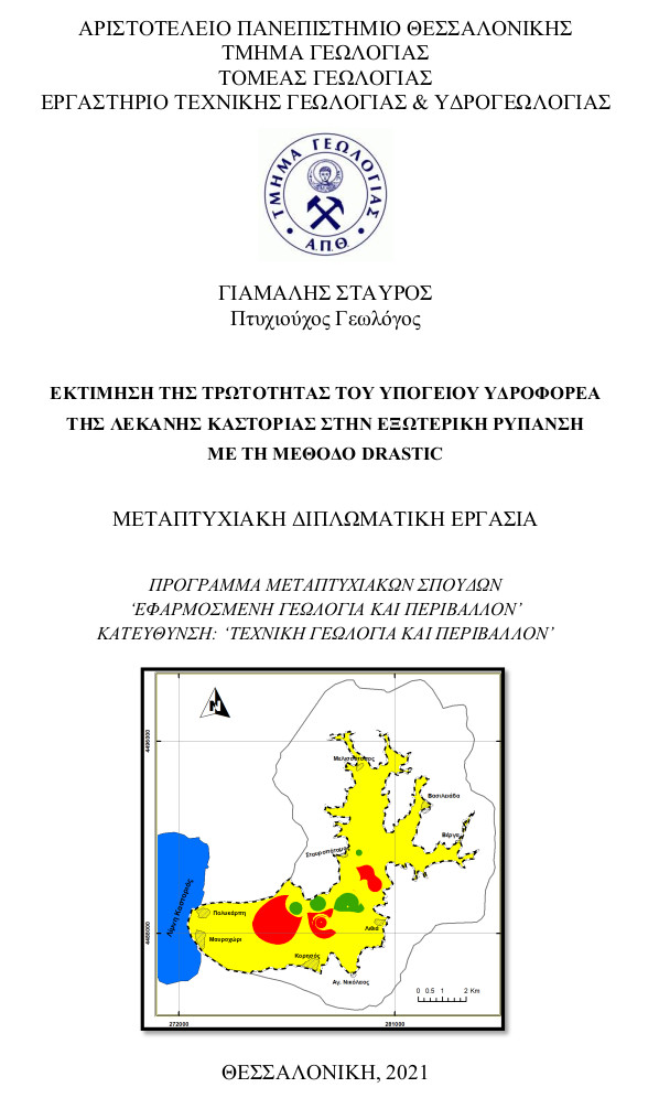
Η παρούσα μεταπτυχιακή διπλωματική εργασία μελετάει την υδρολογική λεκάνη της Καστοριάς, και συγκεκριμένα την υπολεκάνη Κορησού, η οποία βρίσκεται στην Δυτική Ελλάδα, στον νομό Καστοριάς, στον δήμο των Αγίων Αναργύρων. Η ερευνώμενη λεκάνη, αποστραγγίζεται από τον χείμαρρο Ξηροπόταμο, ενώ η έκταση της ανέρχεται στα 89,25 Km2. Μορφολογικά η λεκάνη αποτελείται από την ‘πεδινή’ ζώνη έκτασης 24,6 km2 και την ορεινή ζώνη έκτασης 64,65 km2. Το ανάγλυφο της περιοχής έρευνας εμφανίζεται ημιορεινό, απότομο με μέτριες έως υψηλές κλίσεις. Το υψόμετρο κυμαίνεται από 649 έως 1651 m, με μέση τιμή 984 m και μέση κλίση 28,6%. Αναφορικά με το υδρογραφικό δίκτυο της περιοχής, είναι δενδριτικής μορφής, καλά ανεπτυγμένο με υψηλό συντελεστή διακλάδωσης, ενώ ο κύριος κλάδος του εκτιμήθηκε 5ης τάξης σύμφωνα με την κατάταξη κατά Horton (1945). Γεωτεκτονικά, η περιοχή έρευνας εντάσσεται στην Πελαγονική ζώνη και συνίσταται από τεταρτογενείς χερσαίες αποθέσεις, οι οποίες καλύπτουν το κεντρικό ‘πεδινό’ τμήμα της λεκάνης (27,6% της συνολικής έκτασης) και από κρυσταλλοσχιστώδη πετρώματα του υποβάθρου, που δομούν τον ορεινό όγκο (72,4% της συνολικής έκτασης). Το υδρογεωλογικό ενδιαφέρον εστιάζεται στον προσχωματικό υδροφορέα της λεκάνης, ο οποίος αναπτύσσεται στα τεταρτογενή ιζήματα και θεωρείται ενιαίος. Η τροφοδοσία του υδροφορέα πραγματοποιείται κυρίως μέσω της απευθείας κατείσδυσης του νερού της βροχόπτωσης, από την διήθηση από τις κοίτες του υδρογραφικού δικτύου, και μέσω των επιστροφών του νερού από αρδεύσεις. Τέλος, κύριος στόχος της μεταπτυχιακής διατριβής ήταν η εκτίμηση της ιδιοτρωτότητας του υπόγειου προσχωματικού υδροφορέα της υπολεκάνης Κορησού με την μέθοδο DRASTIC. Σύμφωνα με τα τελικά αποτελέσματα, η λεκάνη παρουσιάζει ως επί το πλείστων μεσαίο δυναμικό στην ρύπανση, δηλ. μεσαία τρωτότητα. Υψηλό δυναμικό στην ρύπανση εμφανίζεται κατά βάση σε μικρό ποσοστό, στο ΝΑ τμήμα του υδροφορέα και σχετίζεται κυρίως με το χαμηλό βάθος της στάθμης του υπόγειου νερού, ενώ αντίστοιχα χαμηλό δυναμικό ρύπανσης εμφανίζεται σε εξίσου πολύ χαμηλό ποσοστό στο κεντρικό τμήμα του υδροφορέα και σχετίζεται κυρίως με το υλικό της ακόρεστης ζώνης το οποίο σε εκείνα τα σημεία εμφανίζεται αργιλικό. Τέλος όσο αφορά τις τιμές των νιτρικών (ΝΟ3-), αυτές κυμαίνονται από 8,8 έως 33,4 mg/l και υπάρχει ικανοποιητική συσχέτιση με τις τιμές τρωτότητας του δείκτη DRASTIC.
The present postgraduate thesis, studies the river basin of Kastoria, and specifically the river sub-basin of Korisos, which is located in Western Greece, in the prefecture of Kastoria, in the municipality of Agioi Anargyroi. The investigated sub-basin, drained from Xiropotamos torrent, while it’s area amounts to 89.25 Km2. Morphologically, the sub-basin consists of the lowland area (24,6 Km2) and the mountainous area (64,65 km2). The topography of the study area, appears semi-mountainous, steep with moderate to high slopes. The altitude ranges from 649 to 1651 m, with an average value of 984 m and an average slope of 28.6%. Regarding the drainage network of the area, it is dendritic, well developed with a high bifurcation ratio, while it’s main tributary is rated as fifth class according to the Horton classification (1945). Geotectonically, the study area is part of the Pelagonian zone and consists of quaternary terrestrial deposits, which cover the central lowland part of the basin (27.6% of the total area) and crystalline and metamorphic rocksfrom the bedrock, which form the mountainous area (72,4% of the total area). The hydrogeological interest, regards the catchment’s alluvial aquifer, which is developed in quaternary sediments and is considered to be unique. Groundwater recharge in the alluvial aquifer occurs from direct infiltration of rainfall, infiltration through torrent beds and return flow of irrigated water. Finally, the main goal of the thesis is to assess the intrinsic vulnerability of the underground alluvial aquifer of the Korisos sub-basin using the DRASTIC method. In accordance to the final conclusions the basin precents for the most part a medium potential of pollution, i.e a moderate vulnerability. High pollution potential, occurs mainly in a small percentage, in the SE part of the aquifer and is mainly related to the low depth of the groundwater level, while correspondingly low pollution potential occurs in a very low percentage in the central part of the aquifer and is mainly related to material of the unsaturated zone, which in those places appears clayey. Finally, regarding the values of nitrates (NO3-), they vary from 8.8 to 33.4 mg/l and there is a satisfactory correlation with the vulnerability values of the DRASTIC index.
Πλήρες Κείμενο:
PDFΑναφορές
Βαφειάδης, Π., 1983. Υδρογεωλογική μελέτη της λεκάνης Καστοριάς. ∆ιδακτορική διατριβή, Τµήµα Γεωλογίας Α.Π.Θ.
Βουδούρης, Κ., 2013. Τεχνική Υδρογεωλογία – Υπόγεια νερά. Εκδόσεις Τζιόλα, Θεσσαλονίκη.
Βουδούρης, Κ., 2016. Υδρογεωλογία Περιβάλλοντος - Υπόγεια νερά & Περιβάλλον. Εκδόσεις Τζιόλα, Θεσσαλονίκη.
Γιαννέλη, Χ., 2009. Υδρογεωλογική έρευνα λεκανών του Ελληνικού χώρου. Παράδειγμα από τη λεκάνη Αγίων Αναργύρων (Καστοριά). ∆ιδακτορική διατριβή, Τµήµα Γεωλογίας Α.Π.Θ.
Μουντράκης, Δ. Μ., 2010. Γεωλογία και Γεωτεκτονική εξέλιξη της Ελλάδας. Εκδόσεις University Studio Press, Θεσσαλονίκη.
Αγγλική Βιβλιογραφία
Aller, L., Bennet, T., Lehr, J. H., Petty, R. J. 1987. DRASTIC: A standardized system for evaluating groundwater pollution potential using hydrogeologic settings. US Environ. Protection Agency EPA/600/2-85-018.
Al-Adamat, R.A.N., Foster, , I.D.L., Baban, S.M.J., 2003. Groundwater vulnerability and risk mapping for the Basaltic aquifer of the Azraq basin of Jordan using GIS, Remote sensing and DRASTIC. Applied Geography, 23 (4), 303-324. doi: 10.1016/j.apgeog.2003.08.007
Al-Zabet, T. 2002. Evaluation of aquifer vulnerability to contamination potential using the DRASTIC method. Environmental Geology 43, 203-208. doi: 10.1007/s00254-002-0645-5
Bhuvaneswaran, C., Ganesh, A., 2019. Spatial assessment of groundwater vulnerability using DRASTIC model with GIS in Uppar odai sub-watershed,
Nandiyar, Cauvery Basin, Tamil Nadu. Groundwater for Sustainable Development, Vol. 9. doi: 10.1016/j.gsd.2019.100270
Foster, S.S.D., Hirata, R., 1988. Groundwater pollution risk assessment: A methodology using available data. Pan Ame. Cent. for Sanit. Engin. and Envir. Scien. (CEPIS) Lima, pp. 81.
Gianneli, C., Voudouris, K., Soulios, G., 2011. Water resources in Korisos basin, NW Greece: interactions between surface and ground water. International Journal of Water, Vol. 6, Nos. 1/2.
Ilhem Abdeslam, Chemseddine Fehdi, Larbi Djabri, 2017. Application of drastic method for determining the vulnerability of an alluvial aquifer: Morsott - El Aouinet north east of Algeria: using arcgis environment. Energy Procedia 119, 308-317. doi: 10.1016/j.egypro.2017.07.114
Mountrakis, D., 1986. The Pelagonian Zone in Greece: A Polyphase-Deformed Fragment of the Cimmerian Continent and Its Role in the Geotectonic Evolution of the Eastern Mediterranean. The Journal of Geology, 94(3), 335–347. doi: 10.1086/629033
Yang, Y. S., Wang, L., 2010. Catchment-scale vulnerability assessment of groundwater pollution from diffuse sources using the DRASTIC method: a case study. Hydrological Sciences Journal – Journal des Sciences Hydrologiques, 55:7, 1206-1216, doi: 10.1080/02626667.2010.508872
Διαδικτυακές Πηγές
Υπουργείο Περιβάλλοντος και Ενέργειας (Εγκεκριμένα Σχέδια Διαχείρισης ΥΔ09- Δυτικής Μακεδονίας, 2014), http://wfdver.ypeka.gr/el/management-plans-gr/approved-management-plans-gr/gr09-approved-gr/
Εθνική Στατιστική Υπηρεσία Ελλάδος (ΕΣΥΕ), https://www.statistics.gr/el/2011-census-pop-hous
Köppen climate classification, 1936, https://el.wikipedia.org/wiki/Κλιματική_ταξινόμηση_Κέππεν
Εισαγωγή στην Τρωτότητα των υπόγειων υδατικών συστημάτων, χ.χ,, file:///C:/Users/stavr/Downloads/01-Εισαγωγικό%20Μάθημα.pdf
Εισερχόμενη Αναφορά
- Δεν υπάρχουν προς το παρόν εισερχόμενες αναφορές.