
Δορυφορική μελέτη των χαρακτηριστικών της υπερκυτταρικής καταιγίδας της 10ης Ιουλίου 2019 = A case study of a supercell on the 10th July, 2019 based on satellite data.
Περίληψη
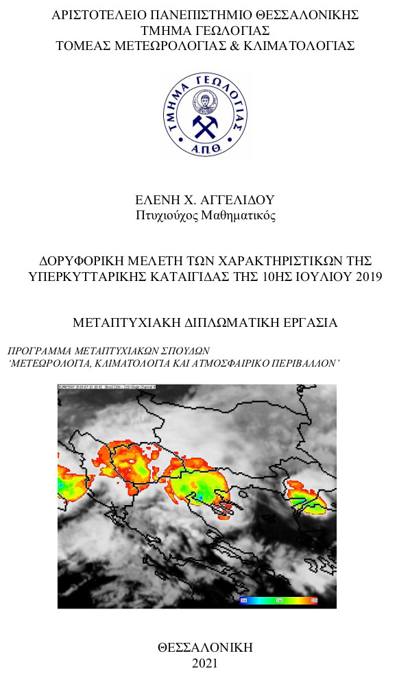
The aim of this study is to identify and examine the spectral and physical characteristics of the storm that hit Chalkidiki, Greece, on July 10, 2019 using remote sensing data. Geostationary and Polar Orbiting Satellite Data (MSG-SEVIRI, Sentinel 2 and 3, GPM) were used in conjunction with ground radar recordings to study and determine the spectral characteristics of the thunderstorm cloud system, based on which, information was extracted for its physical characteristics (height, shape, topography of the top, rainfall distribution, etc.) and their temporal evolution. Storm’s physical characteristics were the basis for investigating the type of the storm (MCS, multicell or supercell). These findings were, subsequently, interpreted in relation to the synoptic characteristics of the atmosphere, as well. Regarding the implementation of the satellite products, this specific study was focused on the analysis of the channels of visible, infrared and water vapor either individually, or in combination with each other, or by differences in these channels. The presence of the visible channel of high resolution (HRV) and the color channels RGB composition played an important role in capturing and interpreting the features of the region with intense convective development. This case study storm proved to have developed supercell characteristics in a mesoscale convective system, which was created because of the favorable environment in southern Europe, and caused severe damages and 7 fatalities mainly in the Chalkidiki peninsula.
Πλήρες Κείμενο:
PDFΑναφορές
Adler, R.F., Fenn, D.D., 1979. Thunderstorm intensity as determined from satellite imagery. J. Appl. Meteorol. 18, 502–517.
Adler, R.F., Markus, M.J., Fenn, D.D., 1985. Detection of severe Midwest thunderstorms using geosynchronous satellite data. Mon. Weather Rev. 113, 769–781.
Adler, R.F., Mack, R.A., 1986. Thunderstorm cloud top dynamics as inferred from satellite observations and a cloud top parcel model. J. Atmos. Sci. 43, 1945–1960.
Alliss, R., and Hoffman, M., 2010: Quasi-Linear Convective System Mesovorticies and Tornadoes. Meteorology Program, Iowa State University, Ames.
Battan LJ, 1959: Radar meteorology. Chicago, University of Chicago Press, 161 pp.
Braun, S. A., , and Monteverdi J. P. , 1991: An analysis of a mesocyclone-induced tornado occurrence in northern California. Wea. Forecasting, 6 , 13–31.
Browning, K. A. and R. J. Donaldson Jr., 1963: Airflow and structure of a tornadic storm. J. Atmos. Sci.,20, 533–545.
Browning, K. A., 1964: Airflow and precipitation trajectories within severe local storms which travel to the right of the winds. J. Atmos. Sci., 21, 634-639.
Browning, K. A., 1965: The evolution of tornadic storms. J. Atmos. Sci., 22, 664-668.
Burgess, D. W., Wood V. T., and Brown R. A., 1982: Mesocyclone evolution statistics (1982). Preprints, 12th Conf. on Severe Local Storms, San Antonio, TX, Amer. Meteor. Soc., 422–424.
Byers, H. R., and R. R. Braham, 1949: The Thunderstorm. Washington, D. C., U. S. Gov’t Printing Office, 287pp.
Christodoulou M, Sioutas M (2014) Supercell storms in Northern and Central Greece. In: Proceedings of twelfth Panhellenic conference of meteorology, climatology and atmospheric physics. Heraklion, Greece, vol 1, pp 186-191.
Christodoulou M., Pytharoulis I., Karacostas T. (2021) The July 10, 2019 Catastrophic Supercell over Northern Greece. Part I: Observational Analyses. In: Proceedings of fifteen Panhellenic Conference of Meteorology, Climatology and Atmospheric Physics. Ioannina, Greece, pp 898-907.
Conover J. H., 1962 "The interpretation of cloud pictures from TIROS meteorological satellites", Jour. SMPTE, vol. 71, pp. 21-25.
EUMETSAT, 2007. A planned change to the MSG Level 1.5 image product radiance definition, Rep. EUM/OPS-MSG/TEN/06/0519, EUMETSAT, Darmstadt, Germany
Feidas H, Giannakos A (2011) Identifying precipitating clouds in Greece using multispectral infrared Meteosat Second Generation satellite data. Theor Appl Climatol. doi:10.1007/s00704-010-0316-5
Fritz S, Laszlo I (1993) Detection of water vapor in the stratosphere over very high clouds in the tropics. J Geophys Res 98 (D12):22959–22967.
Fujita, T. T., 1978: Manual of downburst identification for Project Nimrod. Department of Geophysical Sciences, University of Chicago Satellite and Mesometeorology Research Paper No.156, 104 pp.
Fujita, T. T., 1979: Objective, operation, and results of Project NIMROD. Preprints, 11th Conf. on Severe Local Storms, Kansas City, MO, Amer. Meteor. Soc., 259–266.
Fujita, T.T., 1982. Principle of stereoscopic height computations and their applications to stratospheric cirrus over severe thunderstorms. J. Meteorol. Soc. Jpn. 60, 355–368.
Georgiev, C.G., Santurette, P. (2005). INTERPRETATION GUIDE TO MSG WATER VAPOUR CHANNELS. Academic Press. Copyright © 2005, Elsevier Inc.
Heymsfield, G.M., Blackmer Jr., R.H., Schotz, S., 1983a. Upper level structure of Oklahoma tornadic storms on 2 May 1979, Pt. 1 radar and satellite observations. J. Atmos. Sci. 40, 1740–1755.
Heymsfield, G.M., Szejwach, G., Schotz, S., Blackmer Jr., R.H., 1983b. Upper level structure of Oklahoma tornadic storms on 2 May 1979, Pt. 2 Proposed explanation of “V” pattern and internal warm region in infrared observations. J. Atmos. Sci. 40, 1756–1767.
Heymsfield, G.M., Blackmer Jr., R.H., 1988. Satellite-observed characteristics of Midwest severe thunderstorm anvils. Mon. Weather Rev. 116, 2200–2224.
Heymsfield, G.M., Fulton, R., Spinhirne, J.D., 1991. Aircraft overflight measurements of Midwest severe storms: Implications on geosynchronous satellite interpretations. Mon. Weather Rev. 119, 436–456.
Inoue T (1985) On the temperature and effective emissivity determination of semi-transparent cirrus clouds by bi-spectral measurements in the 10-mm window region. J Meteor Soc
Japan 63:88–99.
Inoue T (1987a) A cloud type classification with NOAA-7 split window measurements. J Geophys Res 92:3991–4000.
Inoue T (1987b) An instantaneous delineation of convective rainfall areas using split window data of NOAA-7 AVHRR. J Meteor Soc Japan 65:469–481.
Inoue T, Wu X, Bessho K (2001) Life cycle of convective activity in terms of cloud type observed by split window. 11th Conference on Satellite Meteorology and Oceanography, Madison, WI, USA.
Johns, R. H., and W. D. Hirt, 1987: Derechos: Widespread convectively induced windstorms. Wea. Forecasting, 2, 32–49.
Klemp, J. B., and R. Wilhelmson, 1978: Simulations of right- and left-moving storms produced through storm splitting. J. Atmos. Sci., 35, 1097–1110.
Klimowski, Β. Α., R. W. Przybylinski, G. Schmocker, and M. R. Hjelmfelt, 2000: Observations of the formation and early evolution of bow echoes. Preprints, 20th Conf. on Severe Local Storms, Orlando, FL, Amer. Meteor. Soc., 44–47.
Klimowski, Β. Α., Hjelmfelt M. R. , , and Bunkers M. J. , 2004: Radar observations of the early evolution of bow echoes. Wea. Forecasting, 19 , 727–734.
Kotroni V, Lagouvardos K (2008) Lightning occurrence in relation with elevation, terrain slope and vegetation cover in the Mediterranean. J Geophys Res 113:D21118.
Kotroni V, Lagouvardos K (2016) Lightning in the Mediterranean and its relation with sea surface temperature.Environ Res Lett 11:034006.
Lagouvardos, K., Kotroni, V., Bezes, A., Koletsis, I., Kopania, T., Lykoudis, S., Mazarakis, N., Papagiannaki, K., and Vougioukas, S. 2017: The automatic weather stations NOANN network of the National Observatory of Athens: operation and database, Geosci. Data J., 4, 4–16, https://doi.org/10.1002/gdj3.44, .
Lee, W.-C., R. E. Carbone, and R. M. Wakimoto, 1992: The evolution and structure of a ‘‘bow-echo–microburst’’ event. Part II: The bow echo. Mon. Wea. Rev., 120, 2211–2225.
Lin, Y.-L., 2007: Mesoscale Dynamics, Chapter 8-Isolated convective storms 272-318 Cambridge University Press,630pp.
Lutz, H-J., Inoue, T., Schmetz, J. 2003 NOTES AND CORRESPONDENCE Comparison of a Splitwindow and a Multi-spectral Cloud Classification for MODIS Observations. Journal of Meteorological Society of Japan, 81, 3, pp 623-631.
McCann, D.W., 1983. The enhanced-V: a satellite observable severe storm signature. Mon. Weather Rev. 111, 887–894.
McCaul, E. W., Jr., 1991: Buoyancy and shear characteristics of hurricane–tornado environments. Mon. Wea. Rev.,119, 1954–1978.
Maddox, R. A., 1976: An evaluation of tornado proximity wind and stability data. Mon. Wea. Rev., 104 , 133–142.
Maddox R. A. (1980): Mesoscale convective complexes. Bull. Amer. Meteor. Soc., 61, 1374–1387
Moller, A. R., C. A. Doswell III, M. P. Foster, and G. R. Woodall, 1994: The operational recognition of supercell thunderstorm environments and storm structure. Wea. Forecasting, 9, 327–347.
Negri, A.J., 1982. Cloud-top structure of tornadic storms on 10 April 1979 from rapid scan and stereo satellite observations. Bull. Am. Meteorol. Soc.63, 1151–1159.
Nolen, R. H., 1959: A radar pattern associated with tornadoes. Bull. Amer. Meteor. Soc., 40, 277–279.
Przybylinski, R. W, and D. M. DeCaire, 1985: Radar signatures associated with the derecho. One type of mesoscale convective system. Preprints, 14th Conf. on Severe Local Storms,
Indianapolis, IN, Amer. Meteor. Soc., 228–231.
Purdom, J.F.W., 1976. Some uses of high-resolution GOES imagery in the mesoscale forecasting of convection and its behavior. Mon. Weather Rev. 104, 1474–1483.
Pytharoulis I., Karacostas T., Christodoulou M., Matsangouras I. (2021) The July 10, 2019 Catastrophic Supercell over Northern Greece. Part II: Numerical modelling. In: Proceedings of fifteen Panhellenic Conference of Meteorology, Climatology and Atmospheric Physics. Ioannina, Greece, pp 1032-1037.
Rodwell, M. J. & Hoskins, B. J. (1996) Monsoons and the dynamics of deserts. Q. J. R. Meteorol. Soc. 122, 1385–1404.
Rotunno, R., and J. B. Klemp, 1982: The influence of the shear-induced pressure gradient on thunderstorm motion. Mon. Wea.Rev.,110,136–151
Schlesinger, R.E., 1984. Mature thunderstorm cloud-top structure and dynamics: a three-dimensional numerical simulation study. J. Atmos. Sci. 41, 1551–1570.
Schlesinger,R.E.,1988. Effects of stratospheric lapse rate on thunderstorm cloud top structure in a three-dimensional numerical simulation. Part I: some basic results of comparative experiments. J. Atmos. Sci. 45, 1555–1570.
Schmetz, J., Tjemkes, S.A., Gube, M., van de Berg, L. 1997 Monitoring deep convection and convective overshooting with METEOSAT. Advances in Space Research, 19, pp 433–441.
Setvák, M., , and Rabin R. M. , 2005: MSG observations of deep convective storms. 2005 EUMETSAT Meteorological Satellite Conf., Dubrovnik, Croatia, EUMETSAT P.46, 460–466.
Setvák, M., R.M. Rabin, P.K. Wang, (2005): Contribution of MODIS instrument to the observations of deep convective storms and stratospheric moisture detection in GOES and MSG imagery. Atmos. Research (submitted in March 2005; accepted for press in September 2005).
Setvák,M.,D.T. Lindsey, P. Novák, P.K. Wang, M. Radová, J. Kerkmann, L. Grasso, S.-H. Su, R.M. Rabin, J. Šťástka, Z. Charvát. (2010) Satellite-observed cold-ring-shaped features atop deep convective clouds. Atmos. Res., 97, pp. 80-96.
Setvák,M., K. Bedka, D.T. Lindsey, A. Sokol, Z. Charvát, J. Šťástka, P.K. Wang, (2013) Academic Press. A-Train observations of deep convective storm tops. Atmos. Res., 123, pp. 229-248.
Sioutas M., Chatzi H., Tegoulias I. (2021) The severe weather outbreak in northern Greece on 10 July 2019: Atmospheric environment and storm characteristics. In: Proceedings of fifteen Panhellenic Conference of Meteorology, Climatology and Atmospheric Physics. Ioannina, Greece, pp 1038-1043.
Weisman, M. L., 1993: The genesis of severe, long-lived bow echoes. J. Atmos. Sci., 50, 645–670.
Weisman, M. L., 2001: Bow echoes: A tribute to T. T. Fujita. Bull. Amer. Meteor. Soc., 82, 97–116.
Weisman, M. L., and J. B. Klemp. 1982. The dependence of numerically simulated convective storms on vertical wind shear and buoyancy. Mon. Wea. Rev. 110:504–520.
Weisman, M. L., and J. B. Klemp, 1986: Characteristics of isolated convective storms. Mesoscale Meteorology and Forecasting, P. S. Ray, Ed., Amer. Meteor. Soc., 331-358.
Weisman, M.L., and R.J. Trapp, 2003: Low-Level Mesovortices within Squall Lines and Bow Echoes. Part I: Overview and Dependence on Environmental Shear. Mon. Wea. Rev., 131, 2779–2803.
Ελληνική Βιβλιογραφία:
Καρτάλης, Κ., & Φείδας, Χ. (2006). Αρχές και εφαρμογές Δορυφορικής Τηλεπισκόπησης (1η). Αθήνα: Γκιούρδας Β.
Ρούπα Π, 2009: Χαρακτηριστικά των ηλεκτρικών εκκενώσεων στον Ελλαδικό χώρο και σχέση αυτών με τον υετό. Μεταπτυχιακή Διατριβή Ειδίκευσης, Τμήμα Γεωλογίας, Αριστοτέλειο Πανεπιστήμιο Θεσσαλονίκης, σελ. 118.
Ηλεκτρονικές ιστοσελίδες:>
Educational Website:
https://glossary.ametsoc.org/wiki/Welcome
http://ww2010.atmos.uiuc.edu/(Gh)/guides/mtr/svr/type/home.rxml
http://ww2010.atmos.uiuc.edu/(Gh)/guides/mtr/svr/type/mline/home.rxml
https://www.weather.gov/lmk/supercell/dynamics
https://www.weather.gov/ama/supercell
https://en.wikipedia.org/wiki/Supercell
https://en.wikipedia.org/wiki/Mesoscale_convective_system
https://www.eoas.ubc.ca/courses/atsc113/flying/met_concepts/04-met_concepts/04a-Tstorm_types/index-basic.html
https://www.eoas.ubc.ca/books/Practical_Meteorology/prmet102/Ch14-Tstorms-v102b.pdf
https://mrcc.illinois.edu/living_wx/thunderstorms/index.html
https://climate.ncsu.edu/edu/StormClassification
https://www.cambridge.org/core/books/mesoscale-dynamics/mesoscale-convective-systems/65DC94BBCFA7C57209A330AA2795F8BB
https://www.esa.int/Applications/Observing_the_Earth/Copernicus/Overview4
https://sentinel.esa.int/documents/247904/685211/Sentinel-2+Products+Specification+Document+%28PSD%29/0f7bedeb-9fbb-4b60-91aa-809162de456c
https://sentinel.esa.int/web/sentinel/missions/sentinel-3/overview
https://www.esa.int/Applications/Observing_the_Earth/Copernicus/Sentinel-2/Facts_and_figures
https://www.esa.int/Applications/Observing_the_Earth/Copernicus/Sentinel-3/Facts_and_figures
https://cimss.ssec.wisc.edu/itwg/itsc/itsc21/program/posters/14p.02_klaes.pdf
METEO: http://onlinelibrary.wiley.com/doi/10.1002/gdj3.44/full
http://eumetrain.org/rgb_quick_guides/index.html
http://photodentro.edu.gr/photodentro/d-balkan_geo_map_v1.6_pidx0014032/story_html5.html
Ηλεκτρονικές σημειώσεις:
Παρουσιάσεις του κ. Φείδα Χαράλαμπου (2019) στα πλαίσια του μαθήματος Δορυφορικής Μετεωρολογίας του Μεταπτυχιακού κύκλου σπουδών Μετεωρολογίας, Κλιματολογίας και Ατμοσφαιρικού Περιβάλλοντος του τμήματος Γεωλογίας, ΑΠΘ.
PowerPoint του κ. Φείδα Χαράλαμπου (2019), Feidas_spectral.
PowerPoint του κ. Φείδα Χαράλαμπου (2019), Mesoscale Convective Systems (MCS) (2019).
Παρουσιάσεις του κ. Πυθαρούλη Ιωάννη (2019) στα πλαίσια του μαθήματος Συνοπτικής Μετεωρολογίας του Μεταπτυχιακού κύκλου σπουδών Μετεωρολογίας, Κλιματολογίας και Ατμοσφαιρικού Περιβάλλοντος του τμήματος Γεωλογίας, ΑΠΘ.
Σημειώσεις του κ. Καρακώστα Θεόδωρου (2019) στα πλαίσια του μαθήματος Δυναμικής Μετεωρολογίας του Μεταπτυχιακού κύκλου σπουδών Μετεωρολογίας, Κλιματολογίας και
Ατμοσφαιρικού Περιβάλλοντος του τμήματος Γεωλογίας, ΑΠΘ.
PowerPoint : Introduction to RGB image composites (2002) , Author : HansPeter Roesli, Meteo Swiss Locarno and Contributors: Jochen Kerkmann (EUM), Daniel Rosenfeld (HUJ), Marianne König (EUM), NWC SAF.
Εισερχόμενη Αναφορά
- Δεν υπάρχουν προς το παρόν εισερχόμενες αναφορές.