
Διερεύνηση ρωγμώσεων στην περιοχή των Λαγυνών Θεσσαλονίκης με τη χρήση γεωφυσικών μεθόδων= Investigation of surface crevasses at the region of Lagyna, using geophysical methods.
Περίληψη
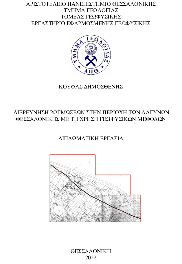
Στην παρούσα διπλωματική εργασία παρουσιάζεται ο συνδυασμός εφαρμογής σεισμικών και ηλεκτρικών γεωφυσικών μεθόδων διασκόπησης, που πραγματοποιήθηκαν τον Μάιο του 2019, στην περιοχή των Λαγυνών Θεσσαλονίκης, με αφορμή την εμφάνιση επιφανειακών ρωγμώσεων στην περιοχή και με σκοπό την ερμηνεία της γεωλογικής και τεκτονικής δομής του υπεδάφους, για την εύρεση του αιτίου που προκάλεσε αυτές τις ρωγμώσεις σε κτίρια στον οικισμό της περιοχής. Η περιοχή μελέτης βρίσκεται στα ΒΑ της Θεσσαλονίκης και ανήκει στο ΝΔ τμήμα της Μυγδονίας λεκάνης. Στην ευρύτερη περιοχή είναι έντονη η γεωργική και βιομηχανική δραστηριότητα με αντίκτυπο την ανεξέλεγκτη υπεράντληση. Για την έρευνα, εφαρμόσθηκαν οι γεωφυσικές μέθοδοι της σεισμικής διάθλασης και της ηλεκτρικής αντίστασης. Η επεξεργασία των σεισμικών έγινε σε περιβάλλον SeisImager/2D, ενώ η τομή ηλεκτρικής τομογραφίας σε περιβάλλον DC_2DPRO. Με την ερμηνεία, συμπεραίνονται κάποιες κάθετες μετατοπίσεις επιφανειακών σχηματισμών, οι οποίες μπορούν να συνδυαστούν με την δράση ασεισμικών κινήσεων ρηγμάτων της περιοχής, τα οποία έχουν μελετηθεί και χαρτογραφηθεί σε παλαιότερες έρευνες στην περιοχή. Οι διαρρήξεις, λοιπόν, πιθανώς οφείλουν την ύπαρξή τους στην δράση των ενεργών ρηγμάτων της λεκάνης, ενώ σημαντικό ρόλο στην καθίζηση των επιφανειακών στρωμάτων, κατέχει η υπεράντληση των υπόγειων υδροφορέων στην περιοχή, λόγω εκτεταμένης γεωργικής και βιομηχανικής δραστηριότητας.
In the presenting senior thesis is presented the combination of applicating of seismic and electrical geophysical methods, that occurred on May of 2019, at the region of Lagyna in Thessaloniki, for the cause of the appearance of surface crevasses at this region and for the purpose of interpretation of the geological and tectonic structure of the subsurface, to explore the cause of these surface crevasses caused to buildings at this settlement. The region of the investigation is located at the NE of Thessaloniki and belongs to the SW department of Mygdonia basin. In the broader region, the agricultural and industrial activity, is excessive, which results to the uncontrolled overdrawing of water. For the research, where applied the geophysical methods of seismic refraction and electrical resistivity. The processing of the seismic signals occurred in the environment of SeisImager/2D, and the electrical tomography was processed in the environment of DC_2DPRO. After the interpretation, some vertical displacements to the surface geological formations are concluded, which could be combined to the activity of non-seismical movements of the faults in the wider region, which have been investigated and mapped in older studies of the location of Mygdonia. The ruptures possibly owe their existence to the activity of active faults of the basin, while significant role to the caving in of the surface strata plays the overdrawing of subsurface aquifers of the region, due to excessive agricultural and industrial activity.
Πλήρες Κείμενο:
PDFΑναφορές
A. ΕΛΛΗΝΙΚΗ ΒΙΒΛΙΟΦΡΑΦΙΑ
• «Εισαγωγή στη Σεισμολογία», Παρουσιάσεις μαθήματος, Τμήμα Γεωλογίας Α.Π.Θ., Τομέας Γεωφυσικής.
• Ζερβοπούλου Α., 2010. Νεοτεκτονικά ρήγματα της ευρύτερης περιοχής της Θεσσαλονίκης σε σχέση με τα εδάφη θεμελίωσης. (Διδακτορική Διατριβή).
• «Ηλεκτρομαγνητικές μέθοδοι Γεωφυσικής Διασκόπησης», Παρουσιάσεις μαθήματος, Τμήμα Γεωλογίας Α.Π.Θ., Τομέας Γεωφυσικής.
• Ινστιτούτο Γεωλογικών και Μεταλλευτικών Ερευνών (Ι.Γ.Μ.Ε): Γεωλογικός χάρτης της Ελλάδος 1:50.000, Φύλλο Θερμόν.
• Ινστιτούτο Γεωλογικών και Μεταλλευτικών Ερευνών (Ι.Γ.Μ.Ε): Τοπογραφικός χάρτης της Ελλάδος 1:50.000, Φύλλο Θερμόν.
• Μανάκου Μ., 2007. Συμβολή στον προσδιορισμό τρισδιάστατου εδαφικού προσομοιώματος για τη μελέτη της σεισμικής απόκρισης: Εφαρμογή στην ιζηματογενή Μυγδονία λεκάνη. (Διδακτορική Διατριβή).
• Μουντράκης, Δ., 2010. Γεωλογία και γεωτεκτονική εξέλιξη της Ελλάδας. Εκδόσεις University Studio Press, Θεσσαλονίκη.
• Παπαζάχος Β. & Παπαζάχου Κ. 1989. Οι σεισμοί της Ελλάδας. Εκδόσεις Ζήτη, Θεσσαλονίκη.
• Παπαζάχος Β., 1996. Εισαγωγή στην εφαρμοσμένη γεωφυσική. Εκδόσεις Ζήτη, Θεσσαλονίκη.
• Παπαζάχος Β. & Παπαζάχου Κ. 2003. Οι σεισμοί της Ελλάδας. Εκδόσεις Ζήτη, Θεσσαλονίκη.
• Παπαζάχος Β. Κ., Καρακαΐσης Γ. Φ., Χατζηδημητρίου Π. Μ., 2005. Εισαγωγή στη σεισμολογία. Εκδόσεις Ζήτη, Θεσσαλονίκη.
• Παυλίδης Σ. Β. 2016. Γεωλογία των Σεισμών: Εισαγωγή στη Νεοτεκτονική, Μορφοτεκτονική, Παλαιοσεισμολογία και Αρχαιοσεισμολογία. Εκδόσεις University Studio Press, Θεσσαλονίκη.
• «Σεισμικές Μέθοδοι Γεωφυσικής Διασκόπησης», Παρουσιάσεις μαθήματος, Τμήμα Γεωλογίας Α.Π.Θ., Τομέας Γεωφυσικής.
• Τσάπανος Θ., Παυλίδης Σ., Χατζηπέτρος Α., 2006. Γεωλογική – Σεισμολογική έρευνα του ρήγματος στο Δ.Δ. Λαγυνών του Δήμου Λαγκαδά. Έκθεση Δήμου Λαγκαδά.
• Τσελέντης Ά. & Παρασκευόπουλος Π., 2013. Εφαρμοσμένη γεωφυσική. Εκδόσεις Liberal Books, Αθήνα.
• Χατζηπέτρος Α., 1998. Παλαιοσεισμολογική- Μορφοτεκτονική μελέτη και μηχανική συμπεριφορά των συστημάτων ενεργών διαρρήξεων, Μυγδονίας, Ανατολικής Χαλκιδικής, Κοζάνης- Γρεβενών. Διδακτορική Διατριβή, Θεσσαλονίκη.
• Ψιλοβίκος Α., 1977. Παλαιογεωγραφική εξέλιξη της λεκάνης και της λίμνης της Μυγδονίας (Λαγκαδά-Βόλβης). Σελίδες 1-256. (Διδακτορική Διατριβή).
Β. ΞΕΝΟΓΛΩΣΣΗ ΒΙΒΛΙΟΓΡΑΦΙΑ
• Alexandridis Th., Takavakoglou V., Crisman Th., Zalidis G., 2006. Remote Sensing & GIS Techniques for Selecting a Sustainable Scenario for Lake Koronia, Greece. Environ Manage, No 39, 9 June 2006.
• Barka, A. A., 1992. The North Anatolian Fault Zone. Annales Tectonicae, Vol. 6.
• Chatzipetros A.A. and Pavlides S.B., 1998. A quantitative morphotectonic approach to the study of active faults; Mygdonia basin, northern Greece. Bulletin of the Geological Society of Greece, Vol. 32, No 1.
• • Chatzipetros, A., Mourouzidou, O., and Pavlides, S., 2003. Recent earthquake activity in a multifractured area as derived by trenching – Mygdonia basin, northern Greece. International Workshop on the North Anatolian, East Anatolian and Dead Sea Fault Systems: Recent Progress in Tectonics and Paleoseismology, and Field Training Course in Paleoseismology, Ankara, Turkey, 31 August-12 September 2003, Abstract volume.
• Chatzipetros A., Kokkalas S., Pavlides S. and Koukouvelas I., 2005. Palaeoseismic data and their implication for active deformation in Greece. Journal of Geodynamics, Vol. 40, No 2-3.
• Chatzipetros, Α., Papadopoulou, E., 2009. A case of active fault migration in Mygdonia basin, northern Greece. IESCA – International Earth Science Colloquium on the Aegean Region, Izmir, Turkey, 7-11 October 2019.
• DC_2DPro Version 0.99, User’s Guide, Jumg- Ho Kim.
• Doveton, S. H., 1986. Log Analysis of subsurface Geology: Concepts and Computer Models. John Wiley & Sons, New York.
• Galanis, O. C., Papazachos, C. B., Hatzidimitriou P. M., Scordilis E. M., 2004. Application of 3-D velocity models and ray tracing in double difference earthquake location algorithms: application to the Mygdonia basin (Northern Greece). Bulletin of the Geological Society of Greece, Vol. XXXVI, Proceedings of the 10th International Congress, Thessaloniki, April 2004.
• Kaufmann G., Kockel F., Mollat H., 1976. Notes on the stratigraphic and paleogeographic position of the Svoula Formation in the Innermost Zone of the Hellenides (northern Greece). Bulletin de la Societe Geologique de France, No 18.
• Lyberis, N., 1984. Tectonic evolution of the Aegean trough in the geological evolution of the Eastern Mediterranean. London, Geological Society, Special Publ. No 17.
• Manakou, M., Raptakis, D., Apostolidis P., Chavez-Garcia F., Pitilakis K. (2007). The 3D geological structure of the Mygdonia basin (Greece) in terms of site response evaluation. 4th International Conference on Earthquake Geotechnical Engineering (4ICEGE). Thessaloniki, Greece.
• Mercier, J. L., Carey-Gailhardis, E., Mouyaris, N. Simeakis, K., Roundouyannis, Th., Anghelidhis, Ch., 1983. Structural analysis of recent and active fault and regional state of stress in the epicentral area of the 1978 Thessaloniki earthquakes (Northern Greece). Tectonics, Vol. 2, No 6, December 1983.
• Mountrakis, D., Psilovikos, A., Papazachos, C. B, 1983. The geotectonic regime of the Thessaloniki earthquakes, in the Thessaloniki, Northern Greece, Earthquake of June 20, 1978 and Its Seismic Sequence. Edited by Papazachos, C. B and Carydis, P.G., Technical Chamber of Greece.
• Papazachos, B., Mountrakis, D., Psilovikos, A., Leventakis, G., 1979. Surface fault traces and fault plane solution of May- June 1978 major shocks in the Thessaloniki area. Tectonophysics, Vol. 53.
• Papazachos, B. C., Mountrakis, D., Psilovikos, A., Leventakis, G., 1980. Focal properties of the 1978 earthquakes in the Thessaloniki area. Bulgarian Geophysical J., Vol. 6.
• Papazachos, B., Tsapanos, T., Panagiotopoulos, D., 1982. A premonitory pattern of earthquakes in Northern Greece. Nature, Vol. 296.
• Pavlides, S., Kilias, A., (1987). Neotectonic and active faults along the Servomacedonian zone (Chalkidiki, N. Greece). Annales Tectonicae, Vol. 1.
• Pavlides, S., Caputo, R., Koukouvelas, I., Kokkalas S., Chatzipetros, A., 2006. Paleioseismological investigations of Aegean- type active faults in mainland Greece and their implications. Geological Society of America, Special Paper 409.
• SeisImager/ 2DTM Manual Version 3.2, Pickwin v. 3.2, Plotrefa v. 2.8, December 2006.
• Sotiriadis, L., Psilovikos, A., Vavliakis, E., Syrides G., 1983. Some Tertiary and Quaternary Basins of Macedonia/Greece. Formation and Evolution. Clausthaler Geologische Abhandlungen, No 44.
• Tranos, M., Papadimitriou, E. Kilias, A., (2003). Thessaloniki – Gerakarou Fault zone (TGFZ): the western extension of the 1978 Thessaloniki earthquake fault (Northern Greece) and seismic hazard assessment. Journal of Structural Geology, Vol. 25.
Γ. ΔΙΑΔΥΚΤΙΑΚΕΣ ΠΗΓΕΣ
• www.geometrics.com/seismographs/ Geometrics StrataView.
• www.geophysics.geo.auth.gr/ss/ Σεισμολογικός Σταθμός Α.Π.Θ.
• www.eqgeogr.weebly.com Greek Database of Seismogenic Sources.
• www.iris-instruments.com/syscal-pro IRIS Instruments.
• www.itsak.gr Ινστιτούτο Τεχνικής Σεισμολογίας και Αντισεισμικών Κατασκευών.
• www.statistics.gr/2011 Ελληνική Στατιστική Αρχή
Εισερχόμενη Αναφορά
- Δεν υπάρχουν προς το παρόν εισερχόμενες αναφορές.