
Ανάλυση του μεσογειακού χαμηλού με χαρακτηριστικά τροπικού κυκλώνα του Νοεμβρίου 2017 = Analysis of the Mediterranean tropical-like cyclone of November2017.
Περίληψη
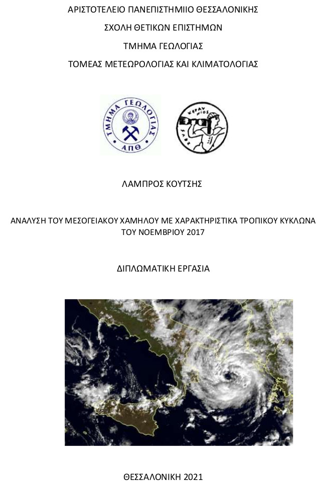
The presence of systems with tropical cyclone characteristics in the Mediterranean became known only in recent decades. These systems were called Mediterranean cyclones, also known as medicanes from the composition of the words Mediterranean Hurricanes. They are very dangerous phenomena that can cause extensive damage in the form of torrential rainfall, floods, strong winds and tornadoes. In some cases they have caused hundreds of deaths and their economic impact is huge. Any region of the Mediterranean can be affected. The predominant areas of formation are the western Mediterranean and the Basin of the Ionian Sea.The purpose of this work was to analyze a barometric low in the period 15-19 November 2017 which in its lifetime acquired the characteristics of a medicane. At the low were given the names Medicane Numa from the Free University of Berlin and Mediterranean cyclone Zenon from the National Observatory of Athens. The analysis of the system was based on operational gridded analyses by the European Centre for Medium-range Weather Forecasts, weather maps of the UK Meteorological Service, meteorological observations, satellite data and lightning data.The parent low came from mainland Italy, moved westwards and was located over the Tyrrhenian Sea on November 15. Then the low moved south and east passing south of Sicily and Malta on November 16. In the evening hours of November 16, it acquired a northern track moving towards the northern Ionian Sea where it remained until the afternoon hours of November 18. It acquired the characteristics of a tropical-like cyclone in the period 17/11/2017 12UTC - 18/11/2017 12UTC. Finally, it made landfall over Greece before dissolving on the shores of Asia Minor. The most extreme precipitation value in a weather station was 84 mm while according to satellite data it was estimated at 220 mm. The system developed in an area with warm sea surface temperature anomalies relative to the climatology. Also important was the contribution of the closed low of geopotential heights in the middle troposphere in combination with the intrusions of the dynamic tropopause before the acquisition of tropical characteristics.
Πλήρες Κείμενο:
PDFΑναφορές
Ξενόγλωσση βιβλιογραφία:
- Bergeron, T. (1954). The problem of tropical hurricanes. Q. J . R. Meteorol. Soc., 80, 131-164.
- Bouin M.N. and Brossier C.L. (2020). Impact of a medicane on the oceanic surface layer from a coupled, kilometre-scale simulation. Ocean Sci., 16, 1125–1142.
- Cavicchia L., von Storch H. and Gualdi S. (2014). A long-term climatology of medicanes. Clim. Dyn., 43, 1183–1195.
- Cioni G., Malguzzi P. and Buzzi A. (2016). Thermal structure and dynamical precursor of a Mediterranean tropical-like cyclone. Q. J. R. Meteorol. Soc., 142, 1757–1766.
- Craig G.C. and Gray S.L. (1996). CISK or WISHE as the mechanism for tropical cyclone intensification. J. Atmos. Sci., 53, 3528–3540.
- Charney J. G. and Eliassen A. (1964). On the growth of the hurricane depression. J. Atmos. Sci., 21, 68-75.
- Emanuel K.A. (1987). An air-sea interaction theory for tropical cyclones. J. Atmos. Sci., 43, 585-605.
- Emanuel Κ.Α. (1994). Atmospheric Convection. Oxford Univ.Press, Oxford.
- Flaounas E., Raveh-Rubin S., Wernli H., Drobinski P. and Bastin S., 2015. The dynamical structure of intense Mediterranean cyclones. Clim. Dyn., 44 (9–10), 2411–2427.
- Gray W.M. (1979). Hurricanes: Their formation, structure and likely role in the tropical circulation, Meteorology Over Tropical Oceans. D. B. Shaw (Ed.), Roy. Meteorol. Soc., James Glaisher House, Grenville Place, Bracknell, Berkshire, RG12 1BX, 155-218.
- Holton J.R. (1972). An Introduction to Dynamic Meteorology. Academic Press, New York, pp.319.
- Homar V., Romero R., Stensrud D.J., Ramis C. and Alonso S. (2003). Numerical diagnosis of a small, quasi-tropical cyclone over the western Mediterranean: Dynamical vs. boundary factors. Ann. of Geophys., 20, 93–106.
- Huffman, G.J., E.F. Stocker, D.T. Bolvin, E.J. Nelkin, Jackson Tan (2019), GPM IMERG Final Precipitation L3 Half Hourly 0.1 degree x 0.1 degree V06, Greenbelt, MD, Goddard Earth Sciences Data and Information Services Center (GES DISC).
- Kerkmann J. and Bachmeier S. (2011). Development of a tropical storm in the Mediterranean Sea (6–9 November 2011). Available at: https://www.eumetsat.int/tropical-storm-develops-mediterranean-sea (last access: 05 September 2021).
- Lagouvardos K., Kotroni V., Nickovic S., Jovic D. and Kallos G. (1999). Observations and model simulations of a winter sub-synoptic vortex over the Central Mediterranean. Meteor. Appl., 6, 371–383.
- Landsea C.W., Bell G.D., Gray W.M and Goldenberg W.M. (1998). The extremely active 1995 Atlantic Hurricane Season: Environmental Conditions and Verification of Seasonal Forecasts. Mon. Wea. Rev., 126, 1174-1193.
- Marra A.C., Federico S., Montopoli M., Avolio E., Baldini L., Casella D., D’Adderio L.P., Dietrich S., Sanò P., Torcasio R.C. and Panegrossi G. (2019). The Precipitation Structure of the Mediterranean Tropical-Like Cyclone Numa: Analysis of GPM Observations and Numerical Weather Prediction Model Simulations. Remote Sensing, 11, 1690.
- Michaelides S., Karacostas T., Sánchez J.L., Retalis A., Pytharoulis I., Homar V., Romero R., Zanis P., Giannakopoulos C., Bühl J., Ansmann A., Merino A., Melcón P., Lagouvardos K., Kotroni V., Bruggeman A., López-Moreno J.I., Berthet C., Katragkou E., Tymvios F., Hadjimitsis D.G., Mamouri R.E. and Nisantzi A. (2018). Reviews and perspectives of high impact atmospheric processes in the Mediterranean. Atmos. Res., 208, 4-44.
- Miglietta M.M., Moscatello A., Conte D., Mannarini G., Lacorata G. and Rotunno R. (2011). Numerical analysis of a Mediterranean ‘hurricane’ over south-eastern Italy: Sensitivity experiments to sea surface temperature. Atmos. Res., 101, 412–426.
- Miglietta M.M., Laviola S., Malvaldi A., Conte D., Levizzani V. and Price, C. (2013). Analysis of tropical-like cyclones over the Mediterranean Sea through a combined modeling and satellite approach. Geophys. Res., 40, 2400-2405.
- Miglietta M. M., Cerrai D., Laviola S., Cattani E. and Levizzani V.(2017). Potential vorticity patterns in Mediterranean “hurricanes”. Geophys. Res., 44, 2537–2545.
- Miglietta M. M., Rotunno R. (2019). Development Mechanisms for Mediterranean Tropical-Like Cyclones (Medicanes). Q. J. R. Meteorol. Soc. 2019.
- Nastos P.T., Papadimou K.K. and Matsangouras I.T. (2018). Mediterranean tropical-like cyclones: Impacts and composite daily means and anomalies of synoptic patterns. Atmos. Res., 206, 156–166.
- Palmen E., 1948. On the formation and structure of tropical hurricanes. Geophys. 3, 26–38.
- Pettersen S. (1956). Weather Analysis and Forecasting, Mac Graw Hill, New York.
- Pytharoulis I., Craig G.C. and Ballard S.P. (2000). The hurricane-like Mediterranean cyclone of January 1995. Meteorol. Appl., 7, 261–279.
- Pytharoulis I. (2018). Analysis of a Mediterranean tropical-like cyclone and its sensitivity to the sea surface temperatures. Atmos. Res., 208, 167-179.
- Rasmussen E. (1979). The polar low as an extratropical CISK disturbance. Q. J. R. Meteorol. Soc., 105, 531-549.
- Romero R. and Emanuel K.A. (2013). Medicane risk in a changing climate. J. Geophys. Res. Atmos., 118, 5992–6001.
- Rotunno R. and Emanuel K.A. (1987). An Air-sea Interaction for Tropical Cyclones. Part II: Evolutionary Study Using Nonhydrostatic Axisymmetric Numerical Model. J. Atmos. Sci., 44, 542-561.
- Shea D.J. and Gray W.M. (1973). The hurricane’s inner core region: I. Symmetric and asymmetric structure, II: Thermal stability and dynamic characteristics. J. Atmos. Sci., 30, 1544-1576.
- Tous, M. and Romero, R. (2013). Meteorological environments associated with medicane Development. Int. J. Climatol., 33, 1-14.
- Yair Y., Lynn B., Price C., Kotroni V., Lagouvardos K., Morin E., Mugnai A. and Llasat M.d.C., 2010. Predicting the potential for lightning activity in Mediterranean storms based on the WRF model dynamic and microphysical fields. J. Geophys. Res., 115, D04205.
- Zahn M. and Storch V.H. (2008). Tracking Polar Lows in CLM. Meteorologische Zeitschrift, 17, 445-453.
- Zahn M. and Storch V.H. (2010). Decreased frequency of North Atlantic polar lows associated with future climate warming. Nature, 467, 309-312.
Ελληνική βιβλιογραφία:
-Δημητριάδου Κ. (2017).Δορυφορική μελέτη βαρομετρικών χαμηλών με χαρακτηριστικά τροπικού κυκλώνα στη Μεσόγειο.Μεταπτυχιακή Διατριβή Ειδίκευσης, Τμήμα Γεωλογίας,Αριστοτέλειο Πανεπιστήμιο Θεσσαλονίκης.
-Καρτάλης, Κ. και Φείδας, Χ. (2012). Αρχές και εφαρμογές δορυφορικής τηλεπισκόπησης. Εκδόσεις Τζιόλα. Θεσσαλονίκη.
-Μακρογιάννης Τ.Ι. και Σαχσαμάνογλου (2004). Μαθήματα Γενικής Μετεωρολογίας. Εκδόσεις Χάρις.Θεσσαλονίκη
-Παρανός Χ. (2016).Συνοπτική και αριθμητική μελέτη βαρομετρικών χαμηλών με χαρακτηριστικά τροπικού κυκλώνα στη Μεσόγειο.Μεταπτυχιακή Διατριβή Ειδίκευσης,Τμήμα Γεωλογίας,Αριστοτέλειο Πανεπιστήμιο Θεσσαλονίκης.
Διαδίκτυο:
-https://www.esa.int/
-https://www.skybrary.aero/
-https://www.metoffice.gov.uk/
-https://earthobservatory.nasa.gov/
-https://www.ecmwf.int/
-https://terra.nasa.gov/
-https://gpm.nasa.gov/
-https://giovanni.gsfc.nasa.gov/
-https://worldview.earthdata.nasa.gov/
-https://www.meteo.gr/
-https://www.meteo.gr/talos
-http://www1.wetter3.de/
- http://www.meteomanz.com/
- https://www.madalvee.com/
- https://www.aoml.noaa.gov/
- https://psl.noaa.gov/
- https://www.nhc.noaa.gov/
-http://cola.gmu.edu/grads/
Εισερχόμενη Αναφορά
- Δεν υπάρχουν προς το παρόν εισερχόμενες αναφορές.