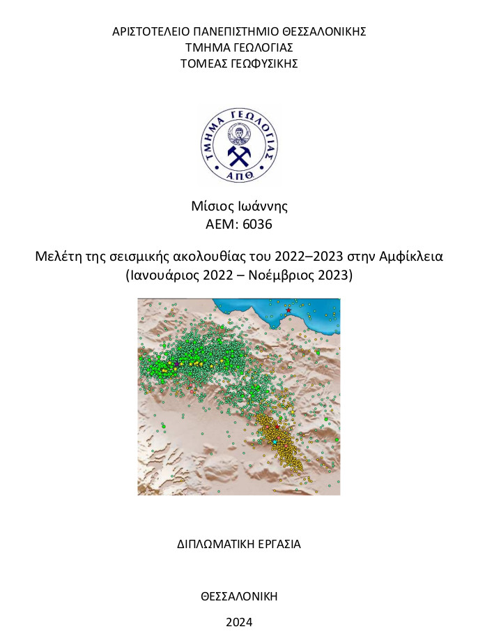
Μελέτη της σεισμικής ακολουθίας του 2022–2023 στην Αμφίκλεια (Ιανουάριος 2022 – Νοέμβριος 2023) = Study of the 2022–2023 seismic sequence in Amfikleia (January 2022 – November 2023).
Περίληψη
Στις 08/06/2023 ένας σεισμός μεγέθους Μ=4.8 εμφανίστηκε στην περιοχή της Αμφίκλειας, στην Κεντρική Ελλάδα, δημιουργώντας μια σεισμική ακολουθία. Το επίκεντρο του κύριου σεισμού βρίσκεται νοτιοδυτικά της κύριας ρηξιγενούς δομής της περιοχής που είναι το ρήγμα μετασχηματισμού της Αταλάντης και είναι ένα κανονικό ρήγμα. Η περιοχή μελέτης αποτελεί τμήμα της περιοχής του Ελληνικού τόξου και τοποθετείται μεταξύ του βουνού του Καλλιδρόμου, της λεκάνης της Λοκρίδας όπως επίσης και της λεκάνης του Βοιωτικού Κηφησού. Γενικά, η περιοχή ενδιαφέροντος είναι σεισμικά ενεργή και αποτελείται από κανονικά ρήγματα εφελκυστικού χαρακτήρα.
Η χρονική διάρκεια καταγραφής της σεισμικής δραστηριότητας ήταν περίπου μισό έτος από την εκδήλωση του κύριου σεισμού. Σε αυτό το χρονικό διάστημα 872 μετασεισμοί ανιχνεύθηκαν. Η χωροχρονική εξέλιξη έδειξε ένα μοτίβο ενεργοποίησης των τεμαχών του ρήγματος προς τα Νοτιοδυτικά.
Ο ισχυρότερος προσεισμός πραγματοποιήθηκε στις 22/01/2023 με μέγεθος Μw=4.2. Η χωρική κατανομή των μετασεισμών της συγκεκριμένης ακολουθίας παρέχει σημαντικές πληροφορίες για την παράταξη του ρήγματος, καθώς τα επίκεντρα των μετασεισμών συγκεντρώνονται κατά μήκος του ενεργού τμήματος του ρήγματος, που προκάλεσε τους σεισμούς αυτούς.
On 08/06/2023 an earthquake of magnitude M=4.8 occurred around Amfiklia, in Central Greece, creating an earthquake sequence. The epicenter of the main earthquake is located southwest of the main fault structure of the region which is the Atalanti transform fault and is a normal fault. The study area is part of the Greek arc region and is located between the Kallidromos mountain, the Locris basin and the Boeotian Kepissos basin. In general, the area of interest is seismically active and consists of normal faults of tensile character.
The period of seismic activity recorded was about half a year after the main earthquake. During this period 872 aftershocks were detected. The spatio-temporal evolution showed a pattern of activation of the fault blocks towards the southwest.
The strongest foreshock occurred on 22/01/2023 with magnitude Mw=4.2. The spatial distribution of the aftershocks of this sequence provides important information about the fault alignment, as the aftershock epicentres are concentrated along the active part of the fault, which caused these earthquakes.
Πλήρες Κείμενο:
PDFΑναφορές
Sidiropoulou A. (2021). Contribution to the better understanding of physical processes associated with microseismicity. 1-10.
Aristotle University of Thessaloniki. (1981). Aristotle University of Thessaloniki Seismological Network [Data set]. International Federation of Digital Seismograph Networks. https://doi.org/10.7914/SN/HT
Delaportas G. (2016). Earthquake August 2013 at Regini Fthiotis: Damages and Restoration Course of the Area. Seismic Hazard Assessment and Preparation of the State Mechanism. 8-10.
Iefimerida. (2019). Earthquake (Mw 6.1). https://www.iefimerida.gr/ellada/i-katagrafi-toy-seismoy-apo-seismografo-stin-kriti
Karamanos Ch. K.1, Karakostas V.1, Seeber L.2, Papadimitriou E., and Kilias A.A.3. (2010). RECENT SEISMIC ACTIVITY IN CENTRAL GREECE REVEALING LOCAL SEISMOTECTONIC PROPERTIES. 2075-2077.
Kissling E., Ellsworth W. L., Eberhart-Phillips D., and Kradofler U. (1994). Initial reference models in local earthquake tomography. J. Geoph. Res. V 99. 635-646.
Kissling E., Solarino S., and Cattaneo M. (1995). Improved seismic velocity reference model from local earthquake data in Northwestern Italy. 528-534.
Kokinou E., Papadimitriou E., Karakostas V., Kamberis E., Vallianatos F. (2006). The Kefalonia Transform Zone (offshore Western Greece) with special emphasis to its towards the Ionian Abyssal Plain. Marine Geophysical Research. 27, 241-252.
Kourouzidis M., Karakaisis G., Papazachos B., and Makropoulos C. (2004). Properties of Foreshocks and Aftershocks in the area of Greece. 1422-1431.
Lee, W.H.K. and J.C. Lahr. (1975). HYPO71: A computer program for determining hypocenter, magnitude, and first motion pattern of local earthquakes. 75-311.
McKenzie D. (1978). Active tectonics of the Alpine—Himalayan belt: the Aegean Sea and surrounding regions. Geophysical Journal International. 55(1), 217-254.
McKenzie D. (1970). Plate tectonics of the Mediterranean region. Nature, 226(5242), 239-243.
Mesimeri M., Karakostas V., Papadimitriou E., Tsaklidis G., Jacobs K. (2018). Relocation of recent seismicity and seismotectonic properties in the Gulf of Corinth (Greece). 1123-1142.
Papazachos B., Scordilis E., Panagiotopoulos D., Papazachos C., and Karakaisis G. (2004). Global relations between seismic fault parameters and moment magnitude of earthquake. 1482-1489.
Scordilis E. M., Karakaisis G., Karakostas B., Panagiotopoulos D., Comninakis P., and Papazachos B. (1985). Evidence for Transform Faulting in the Ionian Sea: The Cephalonia Island Earthquake Sequence of 1983. Pageoph, 123, 388-397.
Μάνος Γ. (2022). Μελέτη της σεισμικής ακολουθίας στον ευρύτερο χώρο της Νισύρου το 2021 (Ιανουάριος – Οκτώβριος 2021). 15-19.
Μπενετάτος Χ.(2007). Λεπτομερής σεισμοτεκτονική μελέτη της ευρύτερης περιοχής του Αιγαίου με τη χρήση ψηφιακών σεισμολογικών δεδομένων. 65-138.
Παπαζάχος Β. και Παπαζάχος Κ.(2002). Οι Σεισμοί της Ελλάδας. Εκδόσεις Ζήτη, 163-305
Παπαζάχος Β., Μουντράκης Δ., Παπαζάχος Κ., Τρανός Μ., Καρακαΐσης Γ., Σαββαΐδης Σ. (2001). Τα ρήγματα που προκάλεσαν τους γνωστούς ισχυρούς σεισμούς στην Ελλάδα από τον 5ο αιώνα π.Χ. μέχρι και σήμερα. 2, 17-26.
Ιστοσελίδες
http://www.geophysics.geo.auth.gr - Τομέας Γεωφυσικής Α.Π.Θ.
https://bbnet.gein.noa.gr - Εθνικό Αστεροσκοπείο Αθηνών (Ν.Ο.Α.).
http://www.usgs.gov - U. S. Geological Survey.
http://www.dggsl.geol.uoa.gr - Εργαστήριο Σεισμολογίας Ε.Κ.Π.Α.
http://geophysics.geo.auth.gr/ss/ - H.U.S.N. (Hellenic Unified Seismological Network).
Για τη κατασκευή των χαρτών σε αυτή την εργασία, χρησιμοποιήθηκαν τα λογισμικά Generic Mapping Tools (GMT) των Wessel and Smith (1988) καθώς και το Quantum Geographic Information System (QGIS) του Gary Sherman (2002).
Εισερχόμενη Αναφορά
- Δεν υπάρχουν προς το παρόν εισερχόμενες αναφορές.
